
Viking Navigation Tools: Forgotten Maritime Technologies
The Vikings were among the most skilled seafarers in history, known for their incredible ability to navigate vast oceans long before modern technology.
Anúncios
Using a combination of innovative tools, environmental cues, and an intricate understanding of astronomy, they successfully traveled across the North Atlantic, reaching places as distant as Greenland and North America.
While much of their maritime expertise remains shrouded in mystery, historical and archaeological findings have shed light on the fascinating Viking navigation tools that enabled these daring voyages. In this article, we explore the forgotten maritime technologies that made Viking exploration possible.
The Challenges of Viking Navigation
Navigating the open seas without compasses, maps, or modern instruments posed significant challenges. The Viking Age (approximately 793–1066 AD) predated the widespread use of magnetic compasses in Europe, meaning Viking sailors had to rely on alternative methods to chart their course.
They faced unpredictable weather conditions, strong ocean currents, and vast, featureless waters where even the slightest miscalculation could result in disaster.
Anúncios
To overcome these challenges, Viking navigators developed a sophisticated system based on celestial observations, landmarks, ocean swells, and even the behavior of birds.
Their ability to read these natural indicators was crucial to their success in long-distance voyages across uncharted territories.
Key Viking Navigation Tools and Techniques
To navigate the unpredictable seas, Viking sailors relied on a variety of innovative techniques and tools.
Their deep understanding of natural elements, such as the sun, stars, ocean currents, and wildlife, allowed them to travel vast distances with remarkable accuracy.
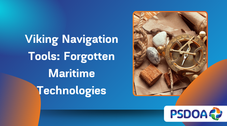
1. The Sun Compass and Sunstone
One of the most debated Viking navigation tools is the sun compass, a device believed to have helped sailors determine direction by tracking the sun’s shadow.
Some archaeological discoveries, such as the Uunartoq disc found in Greenland, suggest that Vikings may have used a primitive sun compass to maintain their bearings during daylight hours.
In addition to the sun compass, historical accounts mention the sunstone, a crystal believed to aid in locating the sun on overcast days.
Icelandic sagas describe Viking navigators using a translucent mineral, possibly calcite, cordierite, or tourmaline, to detect sunlight polarization and determine the sun’s position.
This technique would have been particularly useful in the cloudy and foggy conditions of the North Atlantic.
2. The Lodestone and Early Magnetic Awareness
Although the Vikings did not have magnetic compasses as we know them today, some historians believe they may have experimented with lodestones—naturally magnetized iron ores.
While no direct Viking lodestone compasses have been discovered, some theories suggest that they may have been aware of the stone’s ability to indicate direction.
Even without a working magnetic compass, Viking navigators likely used a deep understanding of prevailing winds and currents to supplement their celestial observations.
By combining multiple techniques, they could maintain remarkable accuracy on their voyages.
Read also: The use of stone arches in ancient structures: Why was this technique abandoned?
3. Bird and Whale Navigation
The Vikings carefully observed animal behavior to aid in navigation. Seafarers often carried ravens aboard their ships, releasing them when they believed land was near.
If the bird returned, it indicated that land was still far away; if it flew in a specific direction without returning, it suggested that land lay in that direction. This method was particularly useful when traveling towards unfamiliar territories.
Whales also played a role in Viking navigation. These large marine mammals tend to follow specific migration routes, often leading towards coastal waters. By monitoring whale movements, Viking sailors could infer their proximity to land.
4. Wave and Swell Patterns
Another fascinating technique used by Viking navigators was their ability to interpret wave and swell patterns.
Different regions of the ocean have distinct wave characteristics based on prevailing winds, underwater topography, and coastal formations. By memorizing these patterns, experienced sailors could estimate their location and adjust their route accordingly.
This skill, known as wave piloting, is still used by some indigenous seafaring cultures today, demonstrating its reliability as a navigation method.
5. Celestial Navigation: Stars and Horizon Markings
Like many ancient mariners, the Vikings relied heavily on celestial navigation. They used the position of the North Star (Polaris) to determine latitude, a crucial factor in maintaining a consistent course.
The movement of other celestial bodies, such as the sun and moon, further aided their navigation, especially on long voyages across the open ocean.
Some historians believe the Vikings also made use of horizon markers—specific landmarks or points on the ship’s rigging that aligned with known celestial bodies. This rudimentary yet effective technique helped them stay on course even when environmental conditions obscured their view of the stars.
The Legacy of Viking Navigation
Despite the lack of modern navigational instruments, the Vikings successfully voyaged across vast distances, reaching as far as Vinland (North America), Greenland, Iceland, and beyond.
Their advanced understanding of natural navigation techniques gave them an unparalleled advantage, enabling them to explore and establish settlements in distant lands.
The legacy of Viking navigation continues to inspire maritime historians and enthusiasts. Many of their techniques laid the groundwork for later European explorers who sought to cross the oceans using improved but fundamentally similar methods.
Today, experimental archaeology and nautical reconstructions, such as the voyages of the reconstructed Viking ship Draken Harald Hårfagre, demonstrate just how effective these ancient techniques were.
Conclusion
The Vikings were not only fearless warriors and traders but also masterful navigators who developed innovative ways to traverse the vast and unpredictable seas.
Through a combination of sunstones, celestial navigation, bird observations, and wave reading, they overcame immense challenges and expanded their influence far beyond their Scandinavian homelands.
While many of their maritime secrets remain lost to time, the Viking navigation tools that have been uncovered highlight their ingenuity and deep understanding of the natural world.
As researchers continue to study Viking seafaring techniques, new discoveries may further reveal the brilliance of these early navigators.
FAQ
1. How did Vikings navigate without a compass?
Vikings relied on natural elements such as the sun, stars, ocean currents, and animal behavior to navigate the seas. They used sunstones to determine the sun’s position on cloudy days and the North Star (Polaris) for orientation.
2. What is a Viking sunstone, and how did it work?
A Viking sunstone was a translucent crystal, possibly calcite, that helped sailors locate the sun even on overcast days by detecting light polarization. This allowed them to maintain their course when direct sunlight was not visible.
3. Did Vikings use maps for navigation?
There is no evidence that Vikings used detailed maps like those developed in later centuries. Instead, they relied on oral traditions, memorized routes, and environmental cues to reach their destinations.
4. How did Vikings use birds for navigation?
Vikings carried ravens aboard their ships and released them when they suspected land was nearby. If the bird returned, it meant no land was in the immediate area. If it flew in a particular direction and did not return, sailors followed that path, assuming it led to land.
5. Did Vikings use lodestones as primitive compasses?
While there is no direct evidence that Vikings used lodestones as compasses, some historians speculate that they may have been aware of magnetic properties and could have experimented with them. However, their primary navigation relied on celestial and environmental observations.